Baltimore
8404 Kelso Drive
Essex MD 21221
(410) 247-7454
Find a Location
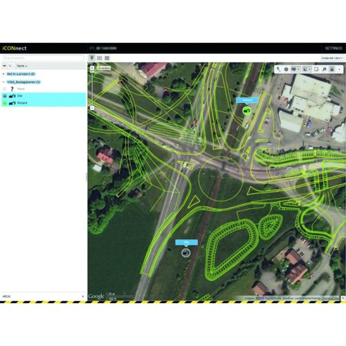
iConnect
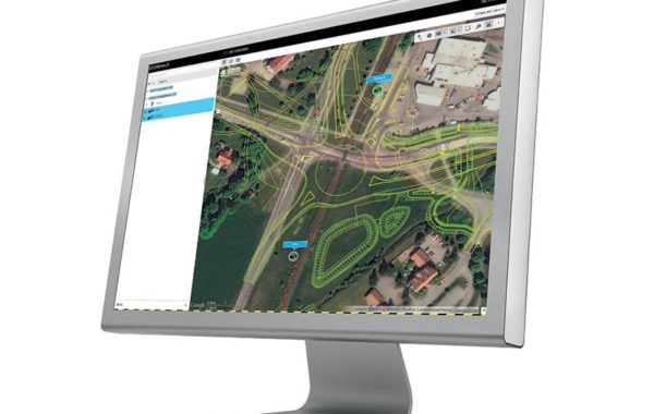
iCONnect
Connect your site and access relevant information anywhere.
CONX is a web-based suite of tools that allow you to increase the efficiency of your machine control operations on site and manage your machinery fleet remotely.
CONX is supplemental to CASE SiteWatch™ telematics as it directly supports the application of machine control equipment on your machine.
View provides the project manager the ability to remotely view the operator’s screen.
View enables remote diagnostic. If the operator needs help, the off-site supervisor can take action on the screen via remote access.
Support personnel can use this function to provide a quick response when needed.
Design data for construction often need to be updated. Sync offers the possibility to upload the latest design data to your fleet immediately.
Manually uploading data via USB stick is no longer required. Data can be transferred remotely in both directions from the field to the office.
Remotely validate individual project files on machines in your fleet, ensuring they are up-to-date.
Track is a fleet management tool which integrates seamlessly into the iCON portfolio.
It allows you to monitor the machine fleet in real-time and provides reports. Entry and exit can be monitored for multiple geographical areas.
Several reports can be created, such as activity, routing and others filtered by calendar, time, geographical area and/or machine type.
GNSS RTK Network Solutions
HxGN SmartNet is a subscription based service offering GNSS Network RTK corrections throughout North America.
HxGN SmartNet provides high-precision, high-availability Network RTK corrections for any application, using any constellation, and is available to everyone.
Hexagon Geosystems directly operates, manages, and maintains all segments of the network, from the reference stations in the field to the server and IT infrastructure.
HxGN SmartNet is built on the powerful Leica Geosystems GNSS Spider software providing a variety of real-time data products to the end-user. It is open to all data formats, offering a GNSS RTK solution to anyone in the precision measurement marketplace.
HxGN SmartNet provides the largest and only North American-wide GNSS RTK Network available in the market today. CASE SiteControl offers everything from the
reconnaissance and installation of the reference stations themselves, managing subscription services, to monitoring the network’s health and operation 24/7.
HxGN SmartNet has opened the doors to new markets in precision measurement across many industries such as Precision Agriculture and GIS, while at the same time providing a stable and reliable infrastructure for the traditional construction and surveying applications.